Monday, January 19, 2015

The First Nine Days

A long line in front of the First Air check-in counters greeted me as I pushed my fully loaded baggage cart through the large sliding doors of the Ottawa International Airport.  It was the early morning of January 3 and I was already sweating underneath my heavy Canada Goose parka.  Here we go again, my mind quipped.
            
My Christmas vacation was short but fun.  I spent time with family & friends, bought school supplies, walked around town, and celebrated New Years.  It was strange to barely see any snow on the ground because Ottawa is usually knee-deep in snow in late December.  I was also surprised by how warm the temperature was, hovering around the minus single digits.  My parents & friends laughed at that observation, saying that I had been spending too much time in the far north.   
            

I visited one of Ottawa's newest landmarks, the Airport Parkway Pedestrian Bridge  (APPB).  I was glad to finally see it completed after being delayed for two years and going over-budget.  Building bridges has been a problem in my hometown for several years, with projects suffering from poor administration, leadership, communication, financing, and scheduling.  The APPB is no exception.  A part of the bridge had to be torn down and rebuilt in 2012 due to problems with the concrete.  Then work was halted in 2013 when design faults were found in the support systems.  The city eventually went with a different company to fix the bridge and is now suing the former contractor for financial compensation.  I can safely say that the bridge didn't collapse when I walked across it twice, and it hasn't collapsed since.
            
Another highlight of my short vacation was having cow tongues for Christmas dinner.  Cow tongue is a delicacy in Eastern Europe, the Middle East, and the Orient.  I tried my first cow tongue out of curiosity 15 years ago and was immediately hooked!  It tastes really good when slow cooked for many hours; the meat is tender & easy to cut.  I would recommend cow tongue to anyone.  Just remember that it tastes better than it looks.
            
The First Air check-in line moved at a snail's pace.  Once I was checked in, I had to drop off all my luggage at the oversized baggage counter.  And a long line was already beginning to form in front of that area.  When I was free of my heavy luggage, I got into another long line to go through security.  By the time I got to my gate and met the other teachers from my school, it was already time to board.  At least the boarding line was short and I was one of the first people to be allowed to step on the plane.  As the First Air plane ascended into the sky, my mind came to the conclusion that there are a lot of lines at airports. 
            
The plane touched down in Iqaluit with ease and taxied to the yellow terminal.  We had about a two-hour wait before the Arctic Bay flight, so I used my time wisely and walked over to Yummy Shawarma for a quick lunch.  The temperature was in the minus thirties but I didn't feel that particularly cold.  The principal joined us on the flight to Arctic Bay.  As the turboprop flew into the clouded arctic skies towards the northwest, it suddenly dawned on me that we were all heading back into dark season.  It would be another month before the sun would reappear in Arctic Bay.
            
Frank was waiting for me at the airport.  He and many other familiar faces greeted me as I walked into the warm & brightly lit terminal building.  The time was 5:40pm but outside, it looked like 8 or 9pm.  After Frank dropped me off at my place, I unpacked, reorganized everything, and relaxed.  It felt nice to be back.
            
Sunday January 4th was spent organizing my classroom, getting rid of old student work that no one would claim, and planning for the first day of the new semester.  I would be teaching three classes this semester: Grade 10 English, Grade 11 Social Studies, and Grade 10 Instrumental Guitar.
            
The first day of school was unexpectedly delayed to Tuesday, January 6th because there were not enough teachers for Monday.  For Tuesday, I introduced myself, shook the hands of several students' and went over the course outlines.  Grade 10 English would be my largest class with 18 students.
            
For the first two weeks, my English students studied literary elements & techniques, and read a variety of short stories.  I preselected the stories based on vocabulary, level of interest, and relevance.  Near the end of the second week, my students began writing their own short stories, using the literary elements & techniques they learned.
            
The Grade 11 Social Studies course would contain much of the same material as last semester; only the student body would be entirely different.  My new students began the course by studying the British Industrial Revolution of 1750-1850.  I slightly tweaked the lessons to include more in depth information about the inventors of the time and the significances of the devices they created.  My students learned about Edmund Cartwright (power loom), James Hargreaves (spinning jenny), Samuel Crompton (spinning mule), and James Watt (steam engine), just to name a few.
            
Music 10 Guitar would also be much of the same as the previous semesters because for now, I'm only teaching a basic guitar course.  However, this time, I'm going to be pushing my students to read traditional notation instead of just relying on guitar tablature, and getting them to perform in front of large audiences.  I'm aiming to have our first school performance in early February when the sun comes back.  Yes, the famous tune, You Are My Sunshine, will be on the repertoire.
            
It's been several months since I bought my skidoo and I'm having lots of fun driving it around town.  It still takes between 10 - 15 minutes to warm it up but that's part of the experience.  I know much gas is wasted because of idleness but when you're dealing with the arctic cold, that's all you can do.  Sometimes, the skidoo needs 20 minutes to warm up.  I haven't had the time to take it out on the land but that's coming up in the spring.  I still need time to acquire a qamutik and camping supplies.  I did, however, receive my new skidoo helmet in the mail.  It protects my entire head & face from injury.  Safety first!  The only snag is that it's a little heavy.  When I wear it with my goggles, I look like Darth Vader or one of his stormtroopers.
            
January 13th, 2015 was a special day for me because on that day, I achieved my first significant milestone in my full-time teaching career: 365 days of teaching!  I began counting the work days when I started teaching in Iqaluit in 2012. 
            
PJ Akeeagok
PJ Akeeagok, recently elected president of the Qikiqtani Inuit Association (QIA), visited Inuujaq School on January 15th to talk to the high school students about the history and roles of the QIA, and the Mary River Project.  He was also in town because the organization decided to hold his swearing-in ceremony at the local community hall (more on this in a future post). 
            
QIA "represents over 14,000 Inuit of the Qikiqtani (Baffin) region... The Qikiqtani region includes 13 communities from Quttiktuq (High Arctic) down to Sanikiluaq (Belcher Islands)."  The organization was established in 1996 and registered as a society in 1997.  They "work closely with [their] partners and different levels of government to ensure the Inuit are being adequately served."  They also make sure the federal & territorial governments are implementing the terms of the Nunavut Land Claims Agreement of 1993.     
            
The QIA presentation was held in the high school science classroom.  I stood at the back and snapped a few pictures.  PJ is originally from Grise Fiord and is fluent in Inuktitut.  I recognized his face when I began teaching Grade 10 Social Studies.  He and three other Inuit students from across Canada assisted in the preparation of the Staking The Claim module several years ago.
            
The entire presentation was conducted in Inuktitut.  I think that was the best course of action because the students would have a better level of understanding.  The southern teachers & I still listened and tried to decipher what was being discussed through body language.  I did understand a few words here and there but I still have a lot more learning to do.
          
At the end of the presentation, PJ and the high school students posed for a group photo.   

Monday, January 5, 2015

A Tour of Nanisivik - Part 2

(The tour occurred on August 31, 2014).

Former Nanisivik town site.
The Nanisivik town site was large enough to accommodate 50 dwellings, a large building complex, a small church, and a metal-domed teepee.  The complex contained a 10-room school, library, gymnasium, pool, bar, two stores, fire hall, daycare, a shop to fix things, the RCMP, a two-cell jail, a government liaison office, and a health centre with residence for (a) nurse(s).  The domed teepee is the same as the ones that are used down south to store highway salt & sand.  In Nanisivik, the teepee was used as a kitchen and cafeteria.  It was known as "The Dome". 
            
Garage owned by the GN. Please
excuse the blurriness.
After the mine closed in 2002, the town site was slowly taken apart.  The complex, dome, and most of the dwellings were dismantled, but a few houses and the church were moved to Arctic Bay.  All that remains at the town site is a garage owned by the Government of NunavutGoogle Earth has yet to update its satellite photographs of the area, so until they do, you can go there and look at the former town from space.
            

We headed down towards the dock, passing a flat piece of land where the mill was located.  The former mill crushed the separated ore into lead & zinc, and waste rock.  Frank stopped his truck about halfway down so that I could take pictures of the surrounding landscape.  The rocky hills had impressive crowns and a small stream ran down a deep rocky cavern towards the docking area.  From where we were standing, we could see snow on one side of "Mount Fuji".
            

Nanisivik Dock
The Nanisivik deep sea dock is quite small compared to other deep sea ports.  Three large circular piers filled with concrete and rocks were built to enable large ships to come closer to shore without running aground.  There were many shipping containers around the dock when we arrived.  What I learned from Frank is that since the mine's closure, the dock has been used by shipping companies & the Coast Guard for the annual sealift every summer. 
            

There are certain places in the north, such as Kugaruuk & Eureka, where sea container ships cannot deliver supplies because of thick ice and/or shallow water.  Those supplies are unloaded at Nanisivik and then transported to those places by the Canadian Coast Guard.  Unfortunately, many of the cargo containers destined for Kugaruuk this year ended up in Churchill, Manitoba because of the icy conditions in Pelly Bay.  The Kugaruuk Co-op had to pay to get those supplies airlifted to the community.
            
There were many large white containers sitting next to the sea containers and wooden boxes near the dock.  They were the living quarters for workers who would be building the tank farm and other infrastructure for the Nanisivik Naval Facility.  I think the tank farm is now complete and construction of the NNF will begin in 2015.
            

The Nanisivik Naval Facility was announced by the federal government in 2007 and much has changed since then, but not for the better.  The original plans called for the construction of a new docking & refuelling facility but the plans were scaled down because the costs proved to be too expensive for the government.  Instead, Nanisivik will be used as a refuelling station for Arctic patrol boats.  If the Canadian government wants to maintain an Arctic presence, they need to stop doing it on-the-cheap and make serious investments in infrastructure and defence.            

Me standing on one of the concrete piers.  Graveyard Point is the tall mountain behind me on the left.
Me sitting in front of the Interim Site
Office.
I walked around the docking area, photographing the circular piers, Admiralty Inlet, the sea containers, and the steep drop looking over the dock.  I also got Frank to take several pictures of me as proof that I did visit the docks.  I also had him take a picture of me sitting in front of National Defence's Interim Site Office.  The long red and white trailer building was built, by order of Defence Minister Peter MacKay, to assert Canadian sovereignty in the north.  The office was locked and not in use during our visit.  How exactly does this assert Canadian sovereignty?, I wondered.
            
T-Intersection.
Nanisivik Airport
Frank drove back the way we came.  When we reached the t-intersection, he continued onward towards the Nanisivik Airport (YSR).  As mentioned in my previous post, the airport was built in the 1970s on top of a plateau that is higher than King George V Mountain (KGVM)!  KGVM stands at a height of 1,642 feet, but according to Google Earth, the airport sits at an altitude of 2,069 feet!  Flights had to be frequently cancelled or delayed due to clouds.  Passengers from Arctic Bay had to drive between 30 - 40 minutes to the airport and a taxi ride cost $40 per person one way.  Those passengers who relied on the taxi service always hoped that their flights would never be delayed and/or cancelled.     
            

Runway.
The 5,000-foot runway enabled jet planes to land as long as they had a gravel kit - a reinforced underbelly so that the fuselage isn't destroyed by all the rocks being kicked up on landing and takeoff.  The runway is built on a pool of muskeg which soaks up water.  It's almost like a liquid and its always moving during the summer time.  If the runway is not maintained, the muskeg will eventually break it up.  The runway had to be placed there because there was no other place with 5,000 feet of level ground and no mountains close by.
            

Maintenance Garage.
In 2010, the airport ceased operations and all flights were transferred to the Arctic Bay Airport (YAB).  YAB only has a 3,000 foot runway and is serviced by turboprops.  It has been 4 years since the closure and yet all the buildings are still there.  The federal government and the Government of Nunavut are arguing over whose responsibility it is to dismantle everything.  Meanwhile there are oil drums and bags of calcium chloride sitting around, as well as the ground is contaminated with oil.  The airport is also in the watershed for Arctic Bay's water lake.  Therefore, any contaminates that can be dissolved in water will end up in the town's water supply.  The federal & territorial governments better come to an agreement really soon.
            

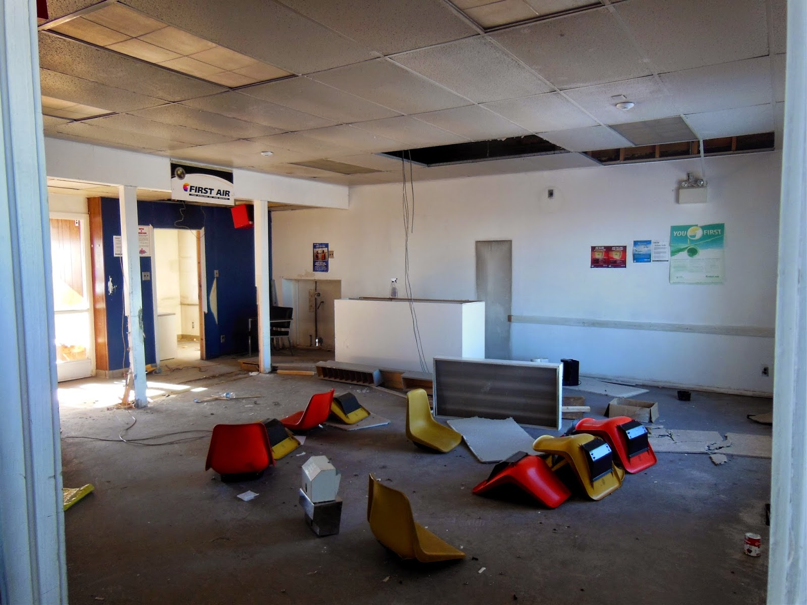
The airport was deserted.  Frank drove onto the tarmac and stopped in front of a small black building that once served as the airport's terminal.  I ventured inside to investigate.  The interior was a mess.  The floor was littered with overturned chairs, tables, wires, and garbage.  Since the closure, people come in, take whatever they want, and leave everything else behind.  I just walked around and took pictures of the departure area, the corridor that leads to the old maintenance garage, and the old weather office. 
           
The old weather office.
Frank told me an interesting story about an Inuit child being born in the old weather office sometime in 1994.  The doctor who performed the delivery adopted the child.
            
To finish off the tour, we drove from one end of the runway to the other.  Frank couldn't drive too fast because large puddles of water dotted the runway.  The landing lights were still in place.  When Frank drove off the runway, I made plans to come back in the new year with my new skidoo and drive back & forth on the runway a couple of times. 
           
Runway landing lights at one end of the runway.
I thanked Frank for the tour as he dropped me off at my place.  The entire excursion lasted 3 hours.


End of Tour of Nanisivik mini-series.

*All in-depth background information was happily provided by long time Arctic Bay resident Frank May.  Thank you.

Friday, January 2, 2015

A Tour of Nanisivik - Part 1


Happy New Year!

Here it is. The long awaited Tour of Nanisivik mini-series.  A perfect way to start off the new year of 2015!
            
Let's rewind the clocks to August 2014.
            
I visited the Nanisivik mine, town site, and airport on August 31, during the Labour Day Weekend.  My tour guide was long time Arctic Bay resident, Frank May.  These places have been on my list of places-to-go ever since I arrived in town two years ago.
            
Nanisivik, meaning the place where people find things in Inuktitut, was a mining town built in 1975 about 20km to the east of Arctic Bay.  It housed & supported, the workers who laboured in the Nanisivik Mine, their families, and local Inuit.  The Nanisivik Mine began operating in 1976, producing lead-zinc ore that was shipped and sold to European smelters.  A deep sea dock was constructed to enable large ships to collect the ore and transport it to Europe.  An airport with a 5,000-foot runway was also constructed to ferry supplies and workers from all over Canada.
            
The mine was managed by Strathcona Minerals Services Limited, the same company that was hired by the TSX to look into the 1996 Bre-X Scandal.  The mine closed in 2002 and the town was abandoned not long after.  The Nanisivik Airport continued to operate until 2010 when all flights were transferred to the newly expanded Arctic Bay Airport.
            
Frank drove his pickup truck along the Road to Nanisivik, the 32km gravel road that links Arctic Bay, the former Nanisivik town site & dock, and the Nanisivik Airport.  At the moment, it's still Nunavut's longest highway.  The first leg of the tour was driving past familiar landmarks: the First Bridge, Liquor Restricted Area Signs, and the Second Bridge.  The Second Bridge was the location of Operation Hill Top 13, 3045 Army's Field Training eXercise (FTX) in September 2013.  The bridge would also be the location for Operation Hill Top 14 the following September. 
            
The Long Stretch
When we passed the Second Bridge, I was venturing into unexplored lands.  For Frank, who has travelled back & forth on this road for more than two decades, this was just another every day road trip.  Frank stopped his truck so that I could get out and take a picture of the Long Stretch, a 5km portion of the road that runs straight.  About halfway down the stretch, we stopped at a former gravel crusher site just to left of the road.  All that remained were the tracks where surface rock was pushed down, scooped up, and put into the crusher.
            
Former rock crushing site.
In 1985, a large crusher was brought up on sealift and placed here with the sole task of taking big rocks and crushing them into sand & gravel.  The sand & gravel would be used to pave the Nanisivik Airport runway.  Even though the crusher was removed in 1986, the machine had crushed enough rock to service the airport until it closed in 2010.
            

Frank's inukshuk
During the 1980s, a snow fence had been built along The Long Stretch to prevent snow from burying the road to Nanisivik.  Frank was one of the workers who laboured on this fence.  What's impressive is the inukshuk he built in 1986 still stands after nearly thirty years. 


"Mount Fuji"
As we came to the end of the Long Stretch, a tall cone-shaped mountain came into view.  The mountain is locally known as "Mount Fuji" because it looks like the real Mount Fuji in Japan.  Frank explained that diamond drilling was done around the mountain until 1990.  A temporary road had to be laid down to make this possible.  He also said that a few people have skied down "Mount Fuji" during the winter months.  After studying the mountain from a distance, I could imagine myself doing the same thing.  I would just need someone with a skidoo to drive me back up to the top.
            
Terry Fox Pass Monument
The next significant monument we visited was Terry Fox Pass (TFP), named after Canadian athlete & cancer research activist, Terry Fox.  TFP was established in the early 1980s by the Polar Pacers and the Midnight Sun Marathoners.  At TFP stands a rock monument with three flag poles (Canada, NWT, Nanisivik Mine), and a tall sign post that gives directions to various cities.  At the base of the monument lays a commemoration plaque.  Betty Fox, Terry Fox's mother, attended the monument's dedication ceremony in 1981.  Terry Fox's younger brother worked as a summer student at the Nanisivik Mine for a time and participated in the marathon. 
            

Frank fixes the directions sign.
One of the main organizers of TFP and the Midnight Sun Marathon was Joe Wormsley, aka Arctic Joe.  Originally from PEI, Wormsley is a former D-Day paratrooper and was once the fittest man in the British Empire.  For twenty-five years, he would travel up north to participate in the Midnight Sun Marathon - Arctic Bay to Nanisivik Dock, and back up to the Nanisivik town site.  Two of these marathons would be held every year during the July 1st weekend.  A 100km marathon was held every 5 years.  About 125 runners from all over the world participated in the marathons and the winners received medals.  Frank was a frequent participant.                      
            

Personally, I don't think I could ever be ready for a marathon.  Sure, I could walk or drive the entire distance but jogging & running?  I don't think so.
            
We got back into the pickup truck and drove onwards.  Frank turned left at the T-intersection towards the mining town and dock area.  (Turning right would have led us to the airport).  We would come back and visit the airport.  Frank calls the T-intersection, "The world's most northerly highway interchange."
            
Naturally occurring iron oxide.
Tailings Pond.
We passed a large red hill covered by naturally occurring iron oxide before arriving at the tailings pond.  Tailings are the waste rock of the mining process, usually high in arsenic and other toxic materials.  The waste rock needs to be disposed and in most cases, mining companies will build a tailings pond.  The pond is the biggest problem of any mining operation because of the toxic substances; you can't let them out into the environment.  Usually, a mining company's water license specifies that all tailings have to be underwater so that they don't get blown away by wind.
            
Tailings Pond.
When the mine closed in 2002, the mining company let the water from the pond drain into the ocean.  The ocean was not damaged because the toxicity is in the sediments at the bottom of the pond.  The company trucked in shale and covered the whole pond 2 metres thick.  This will let the permafrost freeze everything and hopefully hold those tailings until the "end of the time" as Frank put it.  Pipes were later inserted into the pond with thermometers to monitor the permafrost.
            
A rocky hill overlooking the tailings pond. Pipes with thermometers can be seen to the left of centre.
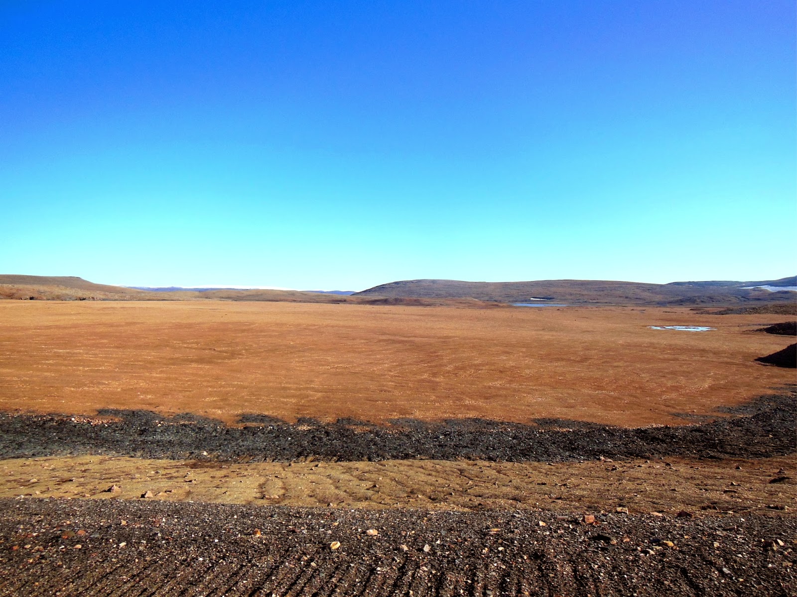
I was surprised by how much land the tailings pond covers.  The Nanisivik Mine produced a lot of waste rock during its twenty-six year operation.  You could build an entire town on top of the flat surface, or stage a large music concert, but I wouldn't recommend it.  Frank drove onto the pond so that we could get a better look at all the pipes.  For several minutes, it was difficult for me to believe that there was water beneath all the shale. 
            
After snapping several more pictures of the pond and "Mount Fuji", Frank drove back onto the main road and proceeded towards the town site.      


To Be Continued . . .
*All in-depth background information was happily provided by long time Arctic Bay resident Frank May.  Thank you.